Sunday, September 28, 2008

Map Update


I found an index of the state road numbers along with their local names on the DOT website. The file came in an Excel file and after some data clean-up, I was able to join the DOT data with the NC Bike Routes Data. There are still some issues with labeling that I am trying to work out. The join did not carry over routes that had no local names. I am working to create an if/then statement to clean up the labels a little more, but have been running into problems selecting null values. Unfortunately, I've burned up a bit of time in trying to get the bike route labels right, so I am not sure what else I will be labeling yet.

Sunday, September 14, 2008

Map Format

So, for another class that I am in, I am tasked with creating a map of the Oakley Community in Asheville. The purpose of the map is to convey the location and size of the community in a manner that could easily be identified by someone who lives in Asheville (via major landmarks and/or streets). It will be displayed on a partial 8.5' X 11' piece of paper (probably 1/3 to 1/2 of the page). I have embedded the work that I have done so far in Google Maps (I will probably export the KML straight to a SHP file). I am wondering if anyone might have any ideas that they could leave me in the comments.


View Larger Map

Type Faces

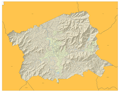
I found the subject of font and type positioning to be somewhat troubling as I set to creating the map of Bike Paths in Buncombe County. I am struggling to find a way in which to cram as much information as would be necessary to create a sufficient map without crowding out the true purpose of the map, which is to convey the location (and possibly the suitability of area bike paths). I will try to post a picture of what my map is looking like tomorrow.