Tuesday, October 7, 2008

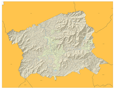
Latest Copy of My Bike Map


So here is the latest copy of my bike map. Still no idea what it will look like printed, but I am reasonably happy with it in the PNG format.

Sunday, September 28, 2008

Map Update


I found an index of the state road numbers along with their local names on the DOT website. The file came in an Excel file and after some data clean-up, I was able to join the DOT data with the NC Bike Routes Data. There are still some issues with labeling that I am trying to work out. The join did not carry over routes that had no local names. I am working to create an if/then statement to clean up the labels a little more, but have been running into problems selecting null values. Unfortunately, I've burned up a bit of time in trying to get the bike route labels right, so I am not sure what else I will be labeling yet.

Sunday, September 14, 2008

Map Format

So, for another class that I am in, I am tasked with creating a map of the Oakley Community in Asheville. The purpose of the map is to convey the location and size of the community in a manner that could easily be identified by someone who lives in Asheville (via major landmarks and/or streets). It will be displayed on a partial 8.5' X 11' piece of paper (probably 1/3 to 1/2 of the page). I have embedded the work that I have done so far in Google Maps (I will probably export the KML straight to a SHP file). I am wondering if anyone might have any ideas that they could leave me in the comments.


View Larger Map

Type Faces

I found the subject of font and type positioning to be somewhat troubling as I set to creating the map of Bike Paths in Buncombe County. I am struggling to find a way in which to cram as much information as would be necessary to create a sufficient map without crowding out the true purpose of the map, which is to convey the location (and possibly the suitability of area bike paths). I will try to post a picture of what my map is looking like tomorrow.

Tuesday, August 26, 2008

GIS 121 - LEAF International Map


Here is our first map of the semester. It shows the program locations of LEAF International. The map was compiled using Batchgeocode.com to create tab delimited text file of the program cities. The tab delimited text file was added into the Map Documented and a shapefile was created from the XY coordinates.